One Click Thematic Map v2.0
Instant visualization for QGIS. Now with advanced classification, styling controls, and export tools.
Instant visualization for QGIS. Now with advanced classification, styling controls, and export tools.
The foundation that made v1 great is still here. Fast, reliable, and one-click simple.
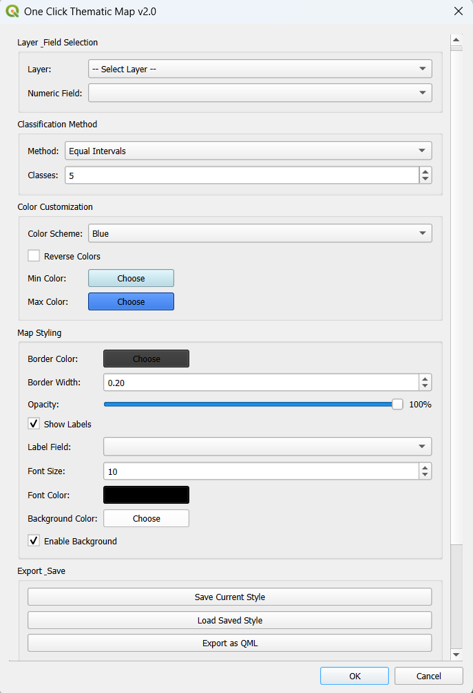
Automatically filters and detects layers with numeric fields. No more scrolling through unrelated text fields.
Select your field, pick a color, and click OK. The simplest workflow in the QGIS ecosystem.
NULL values are handled safely, ensuring your map never crashes due to missing or corrupt data.
Pre-loaded with multiple professional color schemes (Reds, Blues, Spectral) for instant styling.
We've added professional cartography tools without losing the simplicity.
Real-time data analysis panel.
Open QGIS and load your vector/shapefile.
Find the icon in the toolbar or Plugins menu.
Choose your classification method (Jenks, Quantile), adjust colors, and label settings.
Click OK to generate the map instantly or export the style.